The new Power BI ArcGIS Maps provides
you with the ability to build beautiful maps using your data within Microsoft
Power BI. It works with all three versions of Power BI: Free, Pro and Premium.
This release to be defined by the four key updates:
- New connection options
- Enterprise support available
- Support for multiple reference layers
- New table of contents
Enterprise support is now generally available

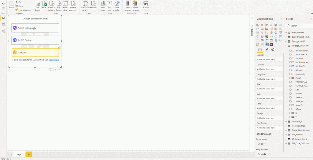
With this release of Power BI, when you click on the ArcGIS Maps for Power BI visual within Power BI, you will now see three connection options:
- ArcGIS Enterprise
- ArcGIS Online
- Standard

The ArcGIS Enterprise and ArcGIS Online options are for users who have the premium app subscription and provides all the capabilities of Standard and extra capabilities, including additional geocoding, technical support, and access to mapping reference layers, and more. The Standard option is free and provides basic mapping capabilities.
Enterprise support available
ArcGIS Enterprise support was released as a public preview. This means that all ArcGIS Enterprise 10.7.1 and above users can connect to their organization’s Enterprise account and use their secure GIS data in dashboards and reports within Power BI. To get started, you would need the ArcGIS maps premium subscription, and then just connect to the ArcGIS visual within Power BI and start mapping.

Support for Multiple reference layers
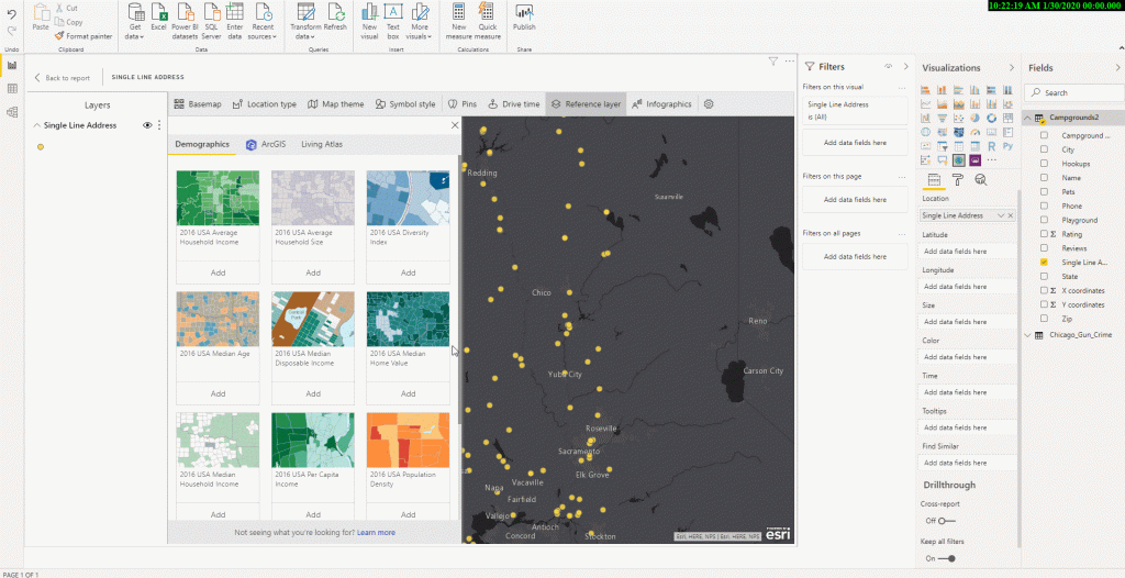
The premium app users can now add multiple reference layers to a single map visualization within Power BI. A reference layer is information represented on a map. It adds context to your operational business data. For example, let’s say you have mapped your store locations in Power BI. You can now overlay it against reference layers such as income, age, competitor locations or other demographics to gain valuable insights. You can add data and layers that are published and shared online by the ArcGIS community as well as layers from your ArcGIS Online or ArcGIS Enterprise organization.

New Table of contents
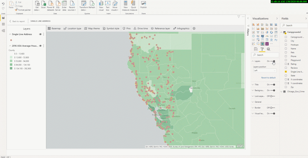
A new table of contents that will help the ArcGIS Maps for Power BI users (free and premium) better visualize their data on a map. Now, when you drag data to a location field well and see it on a map, you can also see a table of contents that lists all the layers on the map and shows the features represented by the layers. This allows your report viewers to quickly understand the data that they are seeing.


